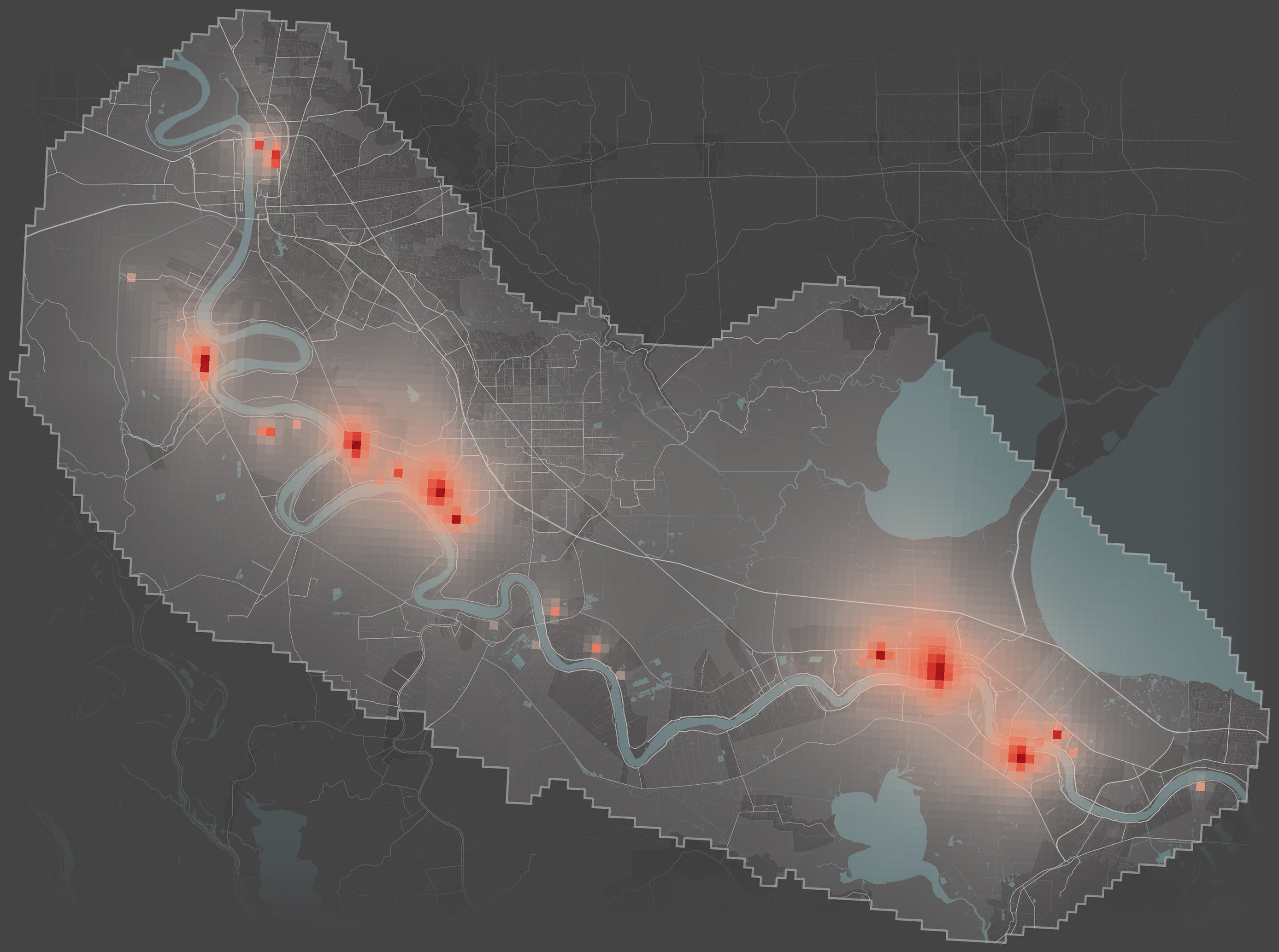
Baton Rouge
LaPlace
New Orleans
Mississippi River
•
•
•
•
•
•
•
•
•
•
•
•
•
•
•
•
•
•
•
•
•
•
•
•
•
•
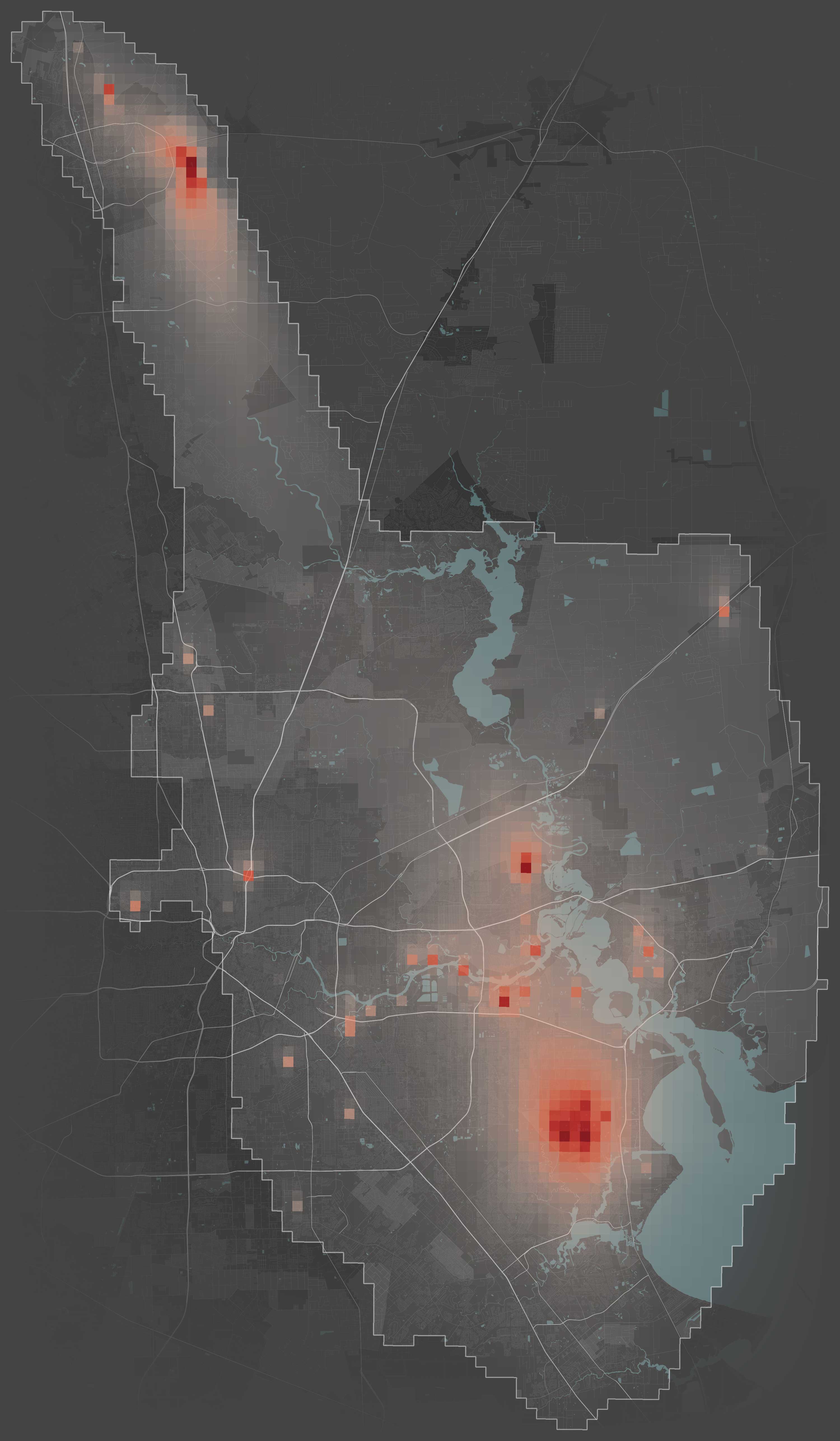
HOUSTON
Pasadena
Bayport
Galveston Bay
•
•
•
•
•
•
•
•
•
•
•
•
•
•
•
•
•
•
•
•
•
•
•
•
•
•
•
•
•
•
•
Charleston, W.Va.
Jefferson, W.Va.
Poca, W.Va.
Kanawha River
•
•
•
•
•


The Most Detailed Map of Cancer-Causing Industrial Air Pollution in the U.S.
The data in this map covers emissions from 2014 to 2018, and was last updated in August 2023 to update corrected Form R submissions. We are no longer making updates.
ProPublica is a nonprofit newsroom that investigates abuses of power. Sign up to receive our biggest stories as soon as they’re published.
It’s not a secret that industrial facilities emit hazardous air pollution.
A new ProPublica analysis shows for the first time just how much toxic air pollution they emit — and how much the chemicals they unleash could be elevating cancer risk in their communities.
ProPublica’s analysis of five years of modeled EPA data identified more than 1,000 toxic hot spots across the country and found that an estimated 250,000 people living in them may be exposed to levels of excess cancer risk that the EPA deems unacceptable.
The agency has long collected the information on which our analysis is based. Thousands of facilities nationwide that are considered large sources of toxic air pollution submit a report to the government each year on their chemical emissions.
But the agency has never released this data in a way that allows the public to understand the risks of breathing the air where they live. Using the reports submitted between 2014 and 2018, we calculated the estimated excess cancer risk from industrial sources across the entire country and mapped it all.
The EPA’s threshold for an acceptable level of cancer risk is 1 in 10,000, meaning that of 10,000 people living in an area, there would likely be one additional case of cancer over a lifetime of exposure. But the agency has also said that ideally, Americans’ added level of cancer risk from air pollution should be far lower, 1 in a million. Our map highlights areas where the additional cancer risk is greater than 1 in 100,000 — 10 times lower than the EPA’s threshold, but still high enough to be of concern, experts say.
Each grid cell is 810 x 810 meters

North →
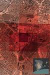
• Huntsman Petrochemical facility
• Groves Middle School
• Port Neches Elementary School
Texas
La.
GULF OF MEXICO
• Beaumont
The estimated excess cancer risk around the facility is higher than 1 in 100 over the course of a lifetime.
Click on a hot spot or browse the map below to learn more about the industrial emissions there, or type in an address to find the increased estimated cancer risk at that location.
Read: Our story | Our methodology | What this means for you


 Click inside a hot spot to see how risks combine there.
Reporting, design, development and data analysis contributed by Allen Tan, Jeff Kao, Lisa Song, Maya Miller, Kiah Collier and Max Blau
Sources: EPA Risk-Screening Environmental Indicators model, EPA Toxics Release Inventory, EPA Integrated Risk Information System, USDA National Agriculture Imagery Program